The history of the bay
The first traces of human activity have been found at the northern edge of Söderfjärden, up on Öjberget. At the end of the Stone Age, approximately 4000 years ago, a seal hunting camp was located there. At that time, the site was an island in the outer archipelago.
The villages of Sundom (formerly Murmursund) and Solf are first mentioned in the early 15th century, which means that the settlement existed as early as in the 14th century, or potentially even earlier. In 1558, 14 fish farmers were actively fishing in Söderfjärden, and paid every sixth pike as tax to King Gustav Vasa in Stockholm. Söderfjärden was for many centuries an important fishing ground for the villages surrounding the bay.
In the 17th century, the average depth of Söderfjärden was about 3 meters, and up until the end of the 18th century people could fish and travel by boat on the bay.
Söderfjärden was rich in reeds, sedges and saltwort, which were harvested for fodder. The sedge and saltwort hay was stored in small log barns built on high foundations until winter.
In the 19th century, the draining of Söderfjärden became a priority. The excavation of Riddardiket, the central canal, began in the 1820s.
Draining the bay
The first dam was built at Munsmo Strömmen in 1776. The purpose was to keep the water out of Söderfjärden and promote grass growth. The digging of the central canal, Riddardiket, began in 1821 and it has since been the most important part of Söderfjärden's drainage system.
The co-owners of the bay held their first meeting in 1907, aiming for a complete drainage. Major disagreement among the partners about how the drainage should be carried out delayed the process.
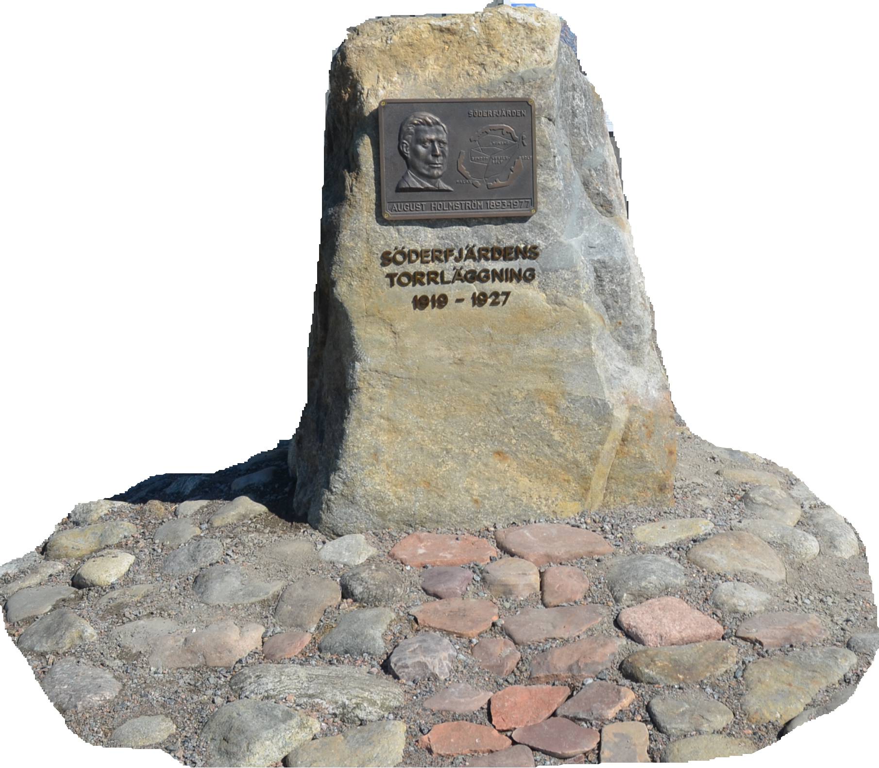
The drainage plans were resumed at a meeting in 1919. In the following years, the drainage was driven forward by a committee chaired by the determined farmer August Holmström.
A bronze relief of August Holmström can be found next to the Meteoria's exhibition agriculture barn.
The opposition to the drainage was extensive. Holmström, the other members and an employed builder had to endure harassment and threats. There was also sabotage, for example, in the autumn of 1923 a dam was blown up and the water level rose so that about 500 hectares of grass embankments and sown autumn fields were flooded. A legislative amendment in the Finnish parliament, "Lex Söderfjärden", deprived the opponents of their legal right to stop the project.
The draining of Söderfjärden was at the time the largest drainage project in Northern Europe. A pumping station was built and in the middle of the great spring flood in 1926 the pumps could be started. Then the open waters became land. In 1927 the draining was fully completed and 1430 additional hectares could be put under the plough.
Today's agriculture
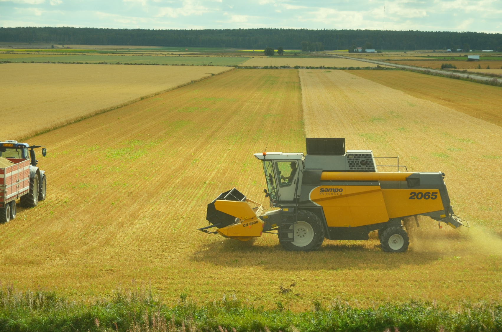
The draining of Söderfjärden in the 1920s gave the area significantly more farmable land. Agriculture was dominated by cattle until the 1960s. At that time, hay was needed in large quantities and Söderfjärden was a kingdom of barns. In the 1940s and 1950s, there were as many as about 3,000 hay barns. With the mechanization of agriculture and increasing grain cultivation, the barns have disappeared one by one. Today, only about 50 barns remain.
Söderfjärden's cultivated area is currently 2,300 hectares. Today, grain is grown on about 80% of the area.
Barley is the dominant grain, but oats and wheat are also grown on significant areas. Smaller plots of rye are also included. Sugar beets, oilseed crops such as turnip rape and rapeseed, and potatoes are other notable crops. Meadows and fallow land can be found on up to 1/10 of the bay's area.
The land on Söderfjärden is farmed by about 15 full-time farmers and about 50 part-time farmers.
In total, there are over 200 landowners on Söderfjärden.
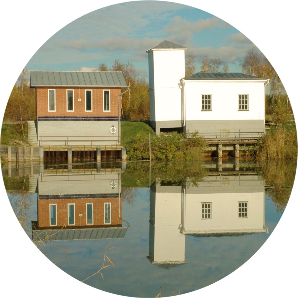
The company Söderfjärdens Torrläggningsföretag with approximately 120 partners maintains and ensures the function of the ditches and the pumping station. The total length of the canals and ditches amounts to 44.5 km. The pumps of the pump house continue to drain 2/3 of the farmland. More info.
Nowadays, the water in the ground is kept at a high level through regulated cover ditching, which is good for the environment and cultivation. This system results in better harvests and reduced emissions of acidic drainage water and heavy metals to the Southern citybay.
The Road Committee for Söderfjärdsvägarna manages approximately 13 km of roads on the farmland.
The farmland of Söderfjärden is a Natura 2000 area. Söderfjärden and parts of the villages of Sundom, Munsmo and Solf constitute a nationally valuable landscape area.
The Meteoria is managed by the Meteoria section of the Sundom Village Association in collaboration with the Vasa Andromeda Astronomical Association.
| Address | Marenvägen 294 65410 Sundom (Vaasa) |
|---|---|
| Phone | +358 50 5565199 |
| meteoria@sundom.fi |